Topo Maps of River Meadows Ranch
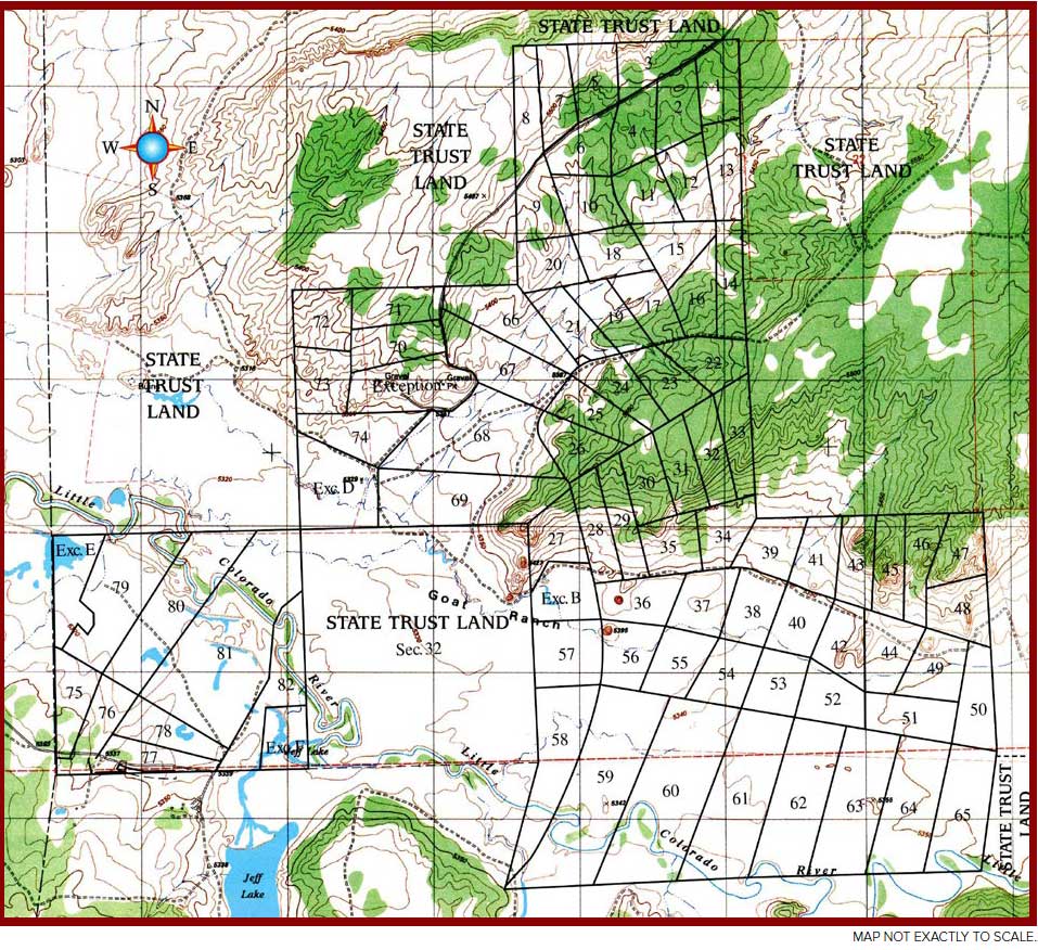
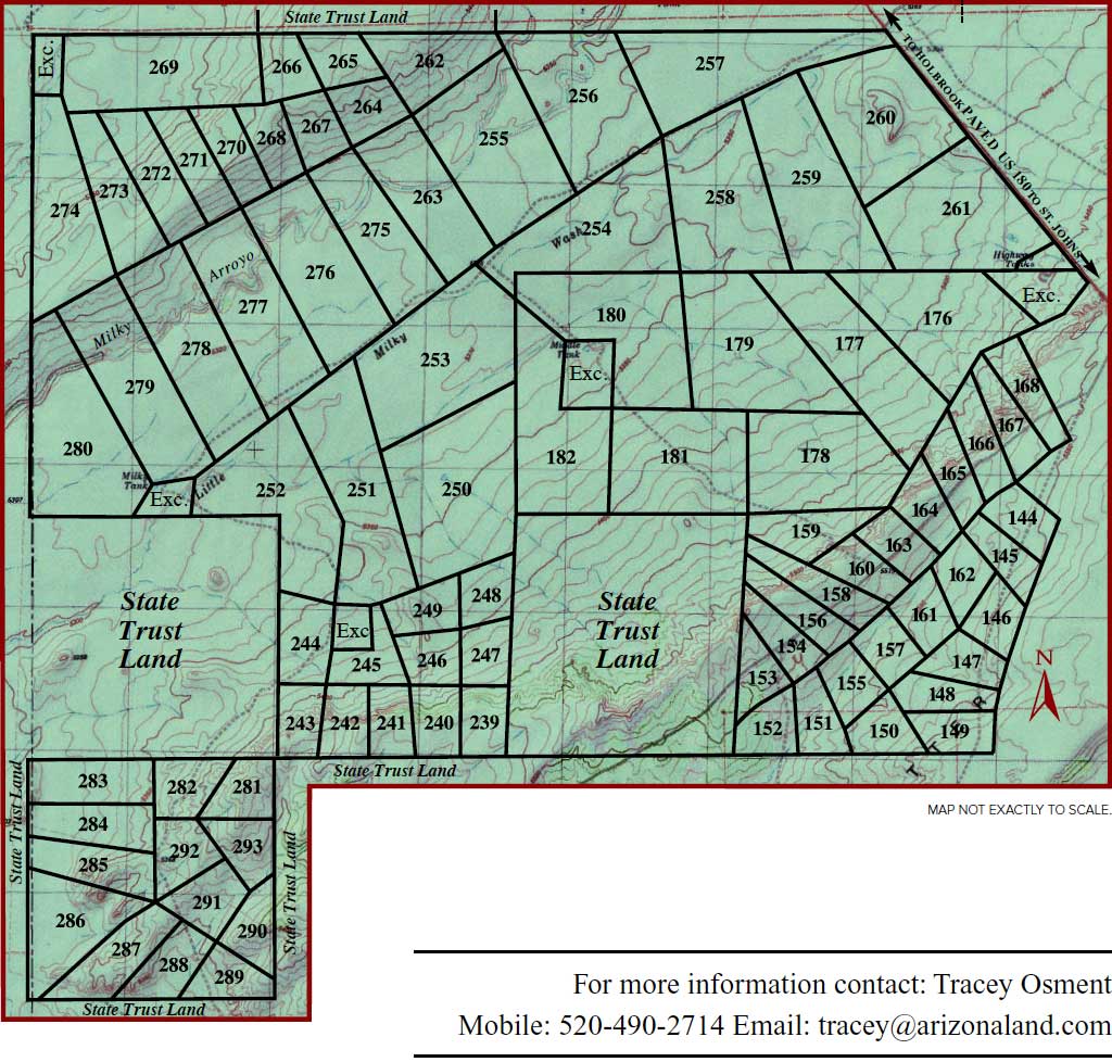
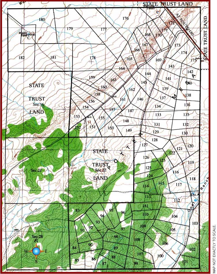
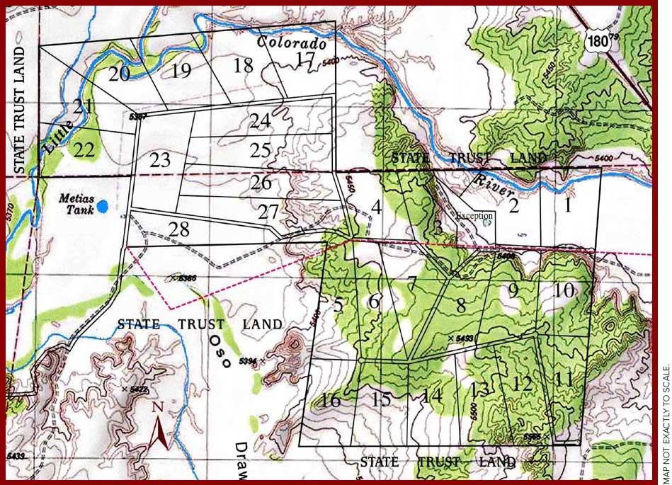
This topographical map illustrates the types of terrain features of properties available within River Meadows Ranch. Many properties depicted have been subject to prior sale. Ask your First United Realty agent for current availability.
PARCELS BELOW ARE A SMALL SAMPLE OF THE SELECTION OF PROPERTIES AVAILABLE IN RIVER MEADOWS RANCH.
LOCATION: Northeastern Arizona, approximately 18 miles northeast of Snowflake and 15 miles southeast of Holbrook in Apache County.
ELEVATION: 5,400 to 5,500 feet above sea level.
ACCESS: Each property has graded dirt road access provided along county recorded titled insured easements. Access to this land is suuitable for conventional vehicles, although the secluded nature of the property calls for SUV or pick up trucks during periods of inclement weather.
GENERAL: River Meadows Ranch South is located along the banks of the Little Colorado River in the cool highlands of east central Arizona. Properties range from 36 to 41 acres in size. All parcels have been surveyed and staked by registered engineers. The land is characterized by heavily wooded hills and ridgetops, lushy grassy meadows, and scenic rock formations. .
TOPOGRAPHY: Most acreages are relatively level, yet include within their boundaries areas of rolling hills or gentle rises that provide excellent building sites overlooking the pastures below. The contour mapping brings out some of this detail. The contour lines are at 10 foot intervals. The closer the spacing between the lines, the more dramatic the elevation changes become.
SOIL: The Little Colorado River valley boats an excellent sandy loam based soil. Area gardeners grow a wide variety of fruit trees and vegetables including apples, peaches, pears, alfalfa, winter wheat, tomatoes, peppers and onions.
WATER: The Little Colorado River South is situated along the south bank of the Little Colorado river. With its headwaters originating high up in the nearby White Mountains, this seasonally flowing river has contributed to an unusually abundant groundwater supply. The main aquifier Underneath the land is the massive Coconino Aquifier, which stretches for miles in all directions in this region of Arizona. River Meadows Ranch South owners have direct access to the aquifier. Registered groundwater reports for the Arizona Department of Water Resources indicates the water depths to be from 200 to 400 ft below the surface and to be of domestic drinking quality.
SPECIAL FEATURES: Power service is available to many River Meadows Ranch South parcels. Power service in a seclided wildernesss environment is very unusual and offers a rare opportunity to own an inexpensive northern Arizona ranch property with the convenience of electricity. In addition, several parcel border large tracts of State Trust Land. These beautiful woodlands and meadows preserved within a State Trust and provide a quiet scenic backdrop for ranch owners.


