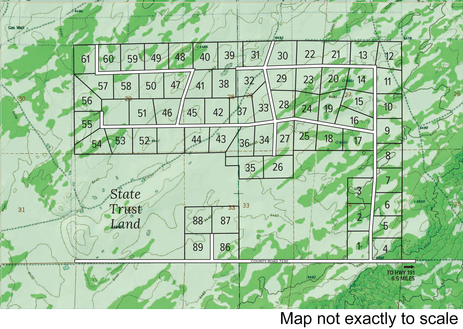
Access: Horizon Ranch is easily accessed via State Route 191. All interior roads are maintained.
Elevation: The Ranch is comprised of over 3,600 acres. The elevations range between 6,400 and 6,500 feet above sea level. The air at this elevation is extremely pure and very clear. The clear dark nighttime sky is arrayed with stars and constellations rarely seen in urban areas.
Water: Ranch owners have direct access to the massive fresh water Coconino Sandstone Aquifer. This aquifer produces abundant ground water for private wells.
Soil: This region of northeastern Arizona enjoys some of the nest sandy loam soils found anywhere in the State. Area owners grow a wide variety of fruits, vegetables and grains including apples, peaches, pears, tomatoes, corn and alfalfa.
Topography: The topographical map illustrates the contours of each property. The contour lines are set at 20 foot intervals. The dark green shaded areas indicate dense concentration of trees. The lighter shaded areas are more lightly wooded and blended with areas of open grassy meadows carpeted with colorful wild owers.
Terrain: There are a variety of terrains and landscapes to choose from. Property choices include level grassy meadowland, gently contoured woodlands blended with portions of pastureland, and parcels generously treed throughout. The gentle contours of each property make every acre usable. There are no deep eroded washes or steep inaccessible portions. Most properties are accented by prominent ridgelines that give their owners a selection of building sites with commanding uninterrupted views of the surrounding wilderness mountains and valleys.
Map not exactly to scale.

